Reading Cities, Sensing Cities: Reflections
As part of the UC Berkeley Global Urban Humanities Initiative Colloquium called Reading Cities, Sensing Cities, students and visitors were asked to write responses to each of the weekly guest lectures. In this blog post, Kristen Larson, a graduate student in the MArch/MCP dual-degree program in Architecture and City and Regional Planning at the UC Berkeley College of Environmental Design, reflects on the conversations and questions raised in the colloquium.
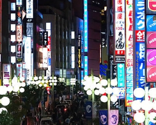
Maps, murals, walking sticks, sensors, stories, recordings, transcripts, scores, photos, poems, and film. I don’t believe I have left anything out, or, perhaps, I have left everything out. How we individually and collectively experience place is a difficult phenomenon to pin down—it is ephemeral yet grounded in the material of sidewalks and building edges and damp underpasses; it is socio-cultural, fleeting yet permanent, conscious, and unconscious. We smell the city and taste its bitter coffee, feel its cracked lanes under thin bike tires, see its foggy hills in the distance, and hear the rumble of helicopters over midnight protests.
As a collection of lectures, conversations, and reflections, Reading Cities, Sensing Cities was a thread of retellings, a series of modes through which we investigate and represent the myriad of multi-sensory experiences that compose the city body. Broad in methods, locations, and motifs, the conversations were underpinned by two reoccurring themes:
1. Questions of academic discipline or branch of knowledge—the lens we gaze through as architects, planners, writers, art historians, musicologists, and/or activists.
2. Questions of representation, description, or portrayal—a dialectic process of reduction and addition, where we sense and select, sense again and draw atop, listen and write, erase and re-write.
Drawing from course discussions, I will circle back to these two broad themes and pose new questions.
Throughout the semester there was a recurring discussion about ways in which different disciplines can learn from each other, particularly from varying forms of investigative methods. What are disciplinary ways of knowing? How do different disciplines interpret data (what we “sense” or “read” in the city)? Architecture (perhaps design in general) is a wholly nonlinear process of intuitive making and reflection, of layering, diagraming, distilling, often of moving along several paths simultaneously. The research question(s) and research method(s) are less clear than in City Planning or Art History. Perhaps it is methodologically more akin to creative writing, perhaps not. Reading Cities, Sensing Cities allowed us to put on a different set of glasses, seeing stories and urban phenomenon through different disciplinary lenses: a history of a Berkeley as told through a logo and mural project; the ephemeral, everyday experience of mega-cities as told through a film where locational specificity is blurred; place and procession as notated and played along a musical score. How can borrowing from different disciplinary methods be emancipatory? In the lecture “Reading the City as a Blind Person,” Chris Downey (Architect) and Georgina Kleege (Writer) discussed non-visual characteristics of the city. In a blog post about this lecture, Jon Pitt describes this way of knowing as “narrative navigation.” He writes that this multi-sensory experience of cities presented by Downey and Kleege is exactly what writers try to evoke in stories.
Questions of representation were also recurring throughout the semester, sometimes leading to contentious discussions. What are some of the links between representation and power? How is representation related to (political) agency? What is an ethics of representation? How does an ethics of representation manifest within different disciplines? In a post about Darin Jensen’s lecture “Mission Possible: A Neighborhood Atlas,” Scott Elder describes the maps of San Francisco’s Mission District as “suggestive juxtapositions” where stories are being uncovered and told through visual data paring. Here the cartographer is an incredibly powerful agent, developing visual and political depictions of the city that tell untold stories, or bringing new phenomenon to the surface. This example and many others from the semester demonstrate the false line so often drawn between “interpretation” and “intervention.” As cartographers, planners, writers, and filmmakers, we sense the city and, through interpretation, represent a part of its story. As we do this in the forms of maps, films, songs, and plans, we add to a collective body of knowledge and material understanding of place. In urban storytelling (in its broadest sense) what is the relationship between interpretation and intervention?